Lozva is the fifth longest river in the Sverdlovsk Region with a length of 637 km and a catchment area of 17, 800 square kilometers. The channel passes through the swamps of the West Siberian Plain within the Garinsky and Ivdel districts and flows into Tavda. Lozva is considered the most picturesque river in the Northern Urals and is of interest for fishing and boating.
The name of the river comes from the Mansi phrase "Lusum Ya", the etiology of which is unknown. The literal translation of this phrase indicates a large number of old women and swampy meadows.
General characteristics of the river
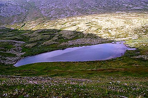
The Lozva River flows from the Lunthusaptur Lake located on the eastern slope of Ortoten Mountain. This place belongs to the Belt Stone ridge of the Northern Urals. The source is located at an altitude of 885.1 meters above sea level within the coordinates 61 ° 32 'north latitude and 59 ° 20' east longitude.
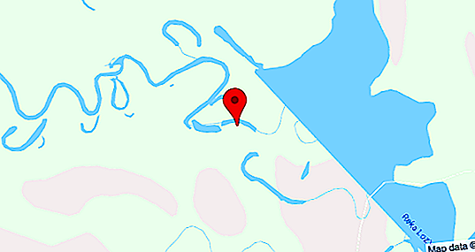
Lozva is a left tributary of Tavda and flows into it at the confluence with Sosva. The height of the estuary above sea level is 56 meters, and the coordinates are 59 ° 34 'north latitude and 63 ° 4' east longitude.
The slope of the river is 1.25 m / km.
River geography
The route of the Lozva River in the Sverdlovsk Region affects both mountainous and lowland areas. In the upper reaches, water flows under the largest slope until it reaches the foot of the ridge. Here the river changes direction from east to south.
Throughout Lozva, the speed of the water flow and the nature of the coasts change, and therefore the river can be divided into several sections:
- The first 3 kilometers from the source are treeless mountain tundra with dry shores, the current is fast.
- Mountain taiga to the foot of the slope - slower flow, dry shores with taiga forest /
- A section with a calmer flow from the mouth of the Akhtyl tributary - the river acquires a flat character, the channel winds with the formation of bays and old ladies, moist banks and marshes periodically meet /
- A section with a mountain course - characterized by steep banks, which in some places form canyons /
- The plain part of the river (from the village of Burmantovo to the mouth of Lozva itself) is characterized by a slow flow, the channel winds among swamps and forests, forming a large number of old women on the way.
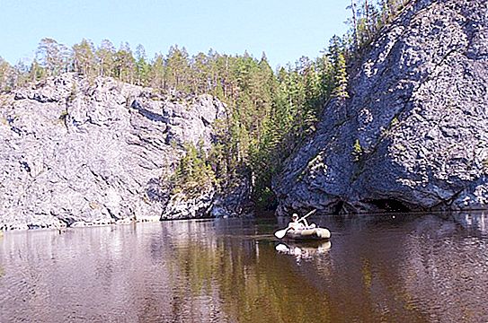
Below the confluence of Ivdeli, the Lozva River passes through a narrow (about one and a half kilometer) valley with steep steep slopes, among which there are also rocky 30-80 m in height. With access to the West Siberian Plain, the floodplain expands to 2-4 km, and the width of the river valley reaches 4-10 km.
Lakes and reservoirs do not meet on the way of the Lozva River.
Settlements
The following settlements are located on the banks of the river:
- Horpia.
- Pershino.
- Lycia.
- Winter.
- Ivdel.
- Shaburovo.
- Mityaevo.
- Burmantovo.
Most of the river basin is located in an uninhabited or sparsely populated area, which leads to a favorable ecological situation.
Water pool
The Lozva River has 45 tributaries, among which the main:
- Auspie.
- Come on.
- Ivdel.
- I drank it.
- Sulpa.
- Manya.
- Colpia.
- Harpy.
- Ushma.
- Big Eve.
- Dust.
- North Toshemka.
The tributaries flowing into the mountain and foothill parts of the river are characterized by very clean cold water and rich ichthyofauna. Some rafting routes pass not only along Lozva, but also along Vizhay, the channel of which passes through picturesque natural places.
Channel characteristics
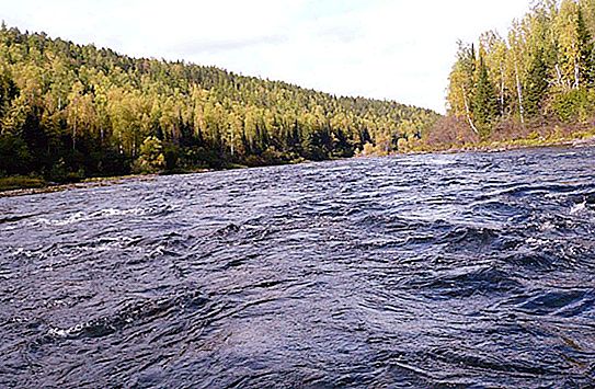
The average depth of the river is one and a half meters. On the rifts it is very small (0.3), and on the stretches it varies from 2 to 2.5 m. The deepest sections are the river pits (up to 6 m). The width of the channel is 30 meters in the upper reaches, 60 - on average and 80 - in the lower. The bottom of the river is mostly stony-pebble with occasionally occurring silty or sandy places.
In the mountainous area (from the upper reaches to the village of Burmantovo), the channel has many rifts, pits and rocky outcrops. It is in this part that the Vladimirsky threshold is located, which is especially difficult for rafting. The section of the river between Burmantovo and Ivdel is calmer. Rifts, pebbles and rocky outcrops are much less common here, but still there.
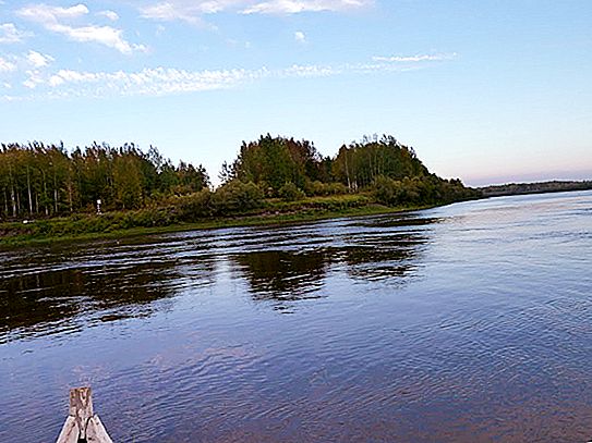
The plain part of the channel (from Ivdel to the mouth) is the longest and deepest (2-3 meters). Reach and pits are more common here. In this area, the channel is very winding and it rinses along the bank turns with the formation of cocks and wood blockages. Plain Lozva has many sleeves and old ladies.
Hydrology
The Lozva River is characterized by mixed nutrition (the main source is snow). The average annual flow rate for measurements 37 km from the mouth is 135.3 m³ / s. The average flow velocity excluding rifts varies from 0.5 to 1.2 m / s. The annual flow is 1.973 cubic kilometers.
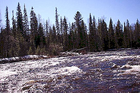
The river freezes at the end of October. Ice drift begins in the second or third spring month. The water level in the Lozva River fluctuates significantly throughout the year. The flood is stretched and lasts from May to July. Floods occur due to rains in late summer and autumn. The difference between the maximum and minimum levels of the Lozva River in the upper reaches is 2-4 meters, and in the lower reaches - 7-8 m.
Nature
The nature of most of the floodplain of the Lozva River is represented by a taiga forest typical of the Northern Urals with a small interspersing of hardwoods (cedar, linden, larch, aspen). In the upper reaches of the shores there are alpine meadows.
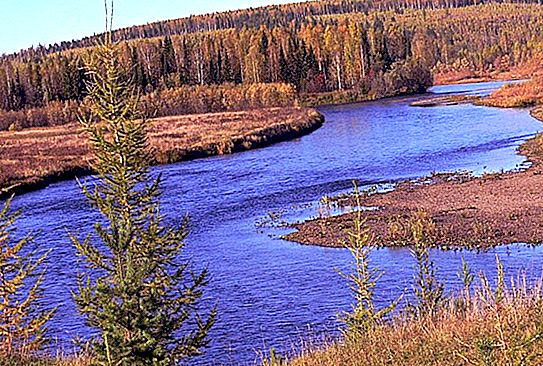
The river itself is quite beautiful, with a wide riverbed and very clear water. The coastal forests are full of game, berries and mushrooms, which makes Lozva suitable for periodic stops during rafting, which can be taken by fishing, gathering or hunting.
Coastal fauna
The fauna of the floodplain of the Lozva River is typical of a taiga forest. Of the wild animals found:
- Brown bear;
- marten;
- reindeer;
- Elk;
- wolf;
- raccoon dog;
- hare;
- roe deer;
- boar;
- a fox;
- flying squirrel (rare Red Book species).
The fauna of birds is especially rich, the diversity of which includes more than 130 species.
Ecology
Currently, the ecosystem of the Lozva River is almost not affected by human activities. Very few settlements are located along the coasts, as a result of which water is not exposed to significant pollution.
Lozwa's main environmental problem is fishing pressure, which has led to a significant decrease in the ichthyofauna populations. In this regard, fisheries were organized in the upper reaches, as well as bans on fishing for taimen, sturgeon and red-listed whitefish.
Alloy
The nature of the rafting on the Lozva River depends on the casting height. The latter can be done in three ways:
- on a motor boat;
- by helicopter (landing on a ridge);
- foot (the most extreme option).
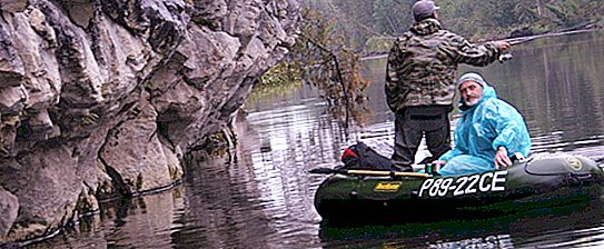
The minimum length of the route is 7 kilometers, and the maximum is 307. The most popular and longest alloy extends from the mouth - Ishma to the village of Burmantovo. If desired, it is possible to continue the route to the confluence of the Ivdel tributary and lower, however, here the river becomes flat, and the flow is much slower. In the presence of a headwind, rafting in this part of the channel is difficult.
Multi-day routes are very common, interspersed with overnight stays on the shore and fishing. Water tourism on Lozva is very well developed.
The route of the alloy is assigned to the first category of complexity. Obstacles on the way can be rapids, blockages and "combs" (typical for the upper). The most difficult to pass Vladimirsky roll.
Fishing
The Lozva River is very rich in ichthyofauna and therefore favorable for fishing. The following fish species live here:
- ruff;
- gudgeon;
- dace;
- roach;
- bream;
- ide;
- tugun;
- pike;
- burbot;
- nelma;
- taimen;
- Siberian sturgeon;
- sterlet;
- common perch;
- Siberian grayling;
- minnow belladonna.
The river has long established itself as a very fishing place, but for the same reason it became an object for mass fishing and the actions of poachers, which led to a significant decrease in the number of representatives of ichthyofauna typical of Lozva. The restrictions imposed by the government have not yet rectified the situation. Currently, fishermen have noted a significant decrease in the size and quality of catches.


