In the heart of Western Siberia, the Vasyugan River flows through a sparsely populated and almost uninhabited area. Describing a rather impressive arc, it flows into the Ob. Where does Vasyugan start? What is the length of this river? What are the common features of its water regime? We will try to answer all these questions in our article.
Vasyugan River: general characteristics
Vasyugan is a natural watercourse in Russia flowing in the southern part of the West Siberian Plain. It belongs to the Ob River basin, being its left tributary. The total length is 1082 kilometers, the catchment area is 61800 square meters. km The average water flow in the channel: 345 m 3 / sec.
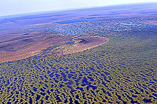
The source of the river is located within the famous Vasyugan marshes (Kargasoksky district of Tomsk region). This is one of the largest swamp massifs in the world. In the upper reaches of the coast of Vasyugan are excessively boggy, and in the floodplain there are many old women and small lakes.
The largest tributaries of Vasyugan:
- Chizhapka (511 km);
- Nyurolka (399 km);
- Yagylyakh (368 km);
- Chertala (311 km);
- Makhnya (211 km);
- Egolyakh (184 km).
The history and origin of the name of the river
Initially, the chum called it Wassis, which translates as “flow”. Later, Khanty tribes settled here. And they added the word "yugan" to the existing name of the river, which translates almost exactly the same - "river". And so it turned out the modern hydronym - Vasyugan. This theory, by the way, is absolutely studied and verified by scientists.
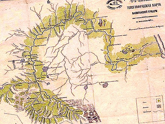
The Vasyugan river basin began to be actively mastered by humans quite recently - in the 30s of the last century. And this development was connected with the mass repressions and deportations that were carried out by the Soviet government during these years. Thus, the most picturesque and uninhabited Vasyugan open spaces were inhabited by representatives of various nationalities. Here they were mainly engaged in felling forests and uprooting of the soil. One of the first maps of the river basin was compiled in 1882.
Today, on the banks of Vasyugan there are 11 small villages and villages. The river is navigable almost 600 km from the mouth (to the village of New Vasyugan). There is no regular passenger service, with the exception of several ferry crossings. In the river basin, rich deposits of oil and natural gas have been explored and developed.
Water regime and nature of the channel
The Vasyugan River, by the characteristics of its water regime, refers to the so-called West Siberian type of natural watercourses. It is characterized by a flood stretching for two to three months (May - July). During this period, the water level in the river can rise up to 7-8 meters. Low water starts in late summer and can be “diluted” with minor autumn floods (in October). The Vasyugan channel is icebound already in early November. A river opens in early May.
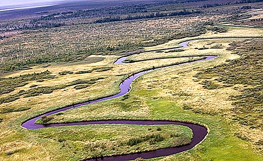
The river bed is characterized by a high degree of meandering (tortuosity). Its width increases from 10-50 m in the upper reaches to 140-200 m in the lower reaches. The slope of the river is insignificant and is only 0.07 ppm.
The Vasyugan flow is smooth, calm - its speed rarely exceeds 1 m / s. The upper reaches are characterized by blockages from twisted roots of trees and topljak. In the lower reaches rifts are widespread, where the depth of the channel does not exceed one and a half meters.


