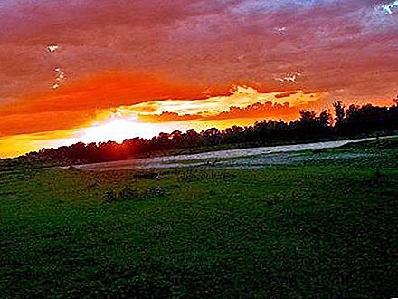
The Chumysh River flows in the Kemerovo region and Altai. She is the right tributary of the Ob. A feature of Chumysh is the presence of two sources - Kara-Chumysh and Tom-Chumysh, which are located in the Kemerovo region (on the Salair ridge).
Geography
The total length of the Chumysh River is 644 km. Its pool has an area of 23, 900 km². The mountain section of the river in the upper reaches is very rapids, with a fast flow. Not far from the mouth, Chumysh is divided into two arms.
At 88 kilometers from Barnaul, downstream, the river flows into the Ob. Most of the Chumysh river basin is located on the Biysk-Chumysh Upland. About 68% of the right bank of the river is occupied by the Predsalair Plain and the Salair Ridge, adjacent to it with its southwestern part.
Hydrology
The Chumysh River receives its food mainly from melting snow (like many Altai rivers), and to a lesser extent from underground sources and rainwater. The river freezes in early November, and “opens” in April (more often in the second half of the month).
In the XXI century Chumysh chopped. Therefore, river shipping has become impossible. But in the 19th and early 20th centuries, ships walked along the river. However, at present, only small vessels can move to the village of Yeltsovka.
Main tributaries
The largest tributaries of the described river are:
- the source of the Chumysh river (it is its left tributary) is the Kara-Chumysh river 173 km long;
- Uksunay right tributary (165 km);
- Alambay (right tributary with a length of 140 km);
- the right tributary of the Tom Chumysh is 110 km long.
Further along the length follow: Sungai (103 km, right); Talmenka (99 km, right) and Sary-Chumysh (98 km, left).
Description
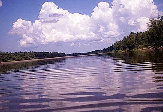
Near the village of Kostenkovo, the river is so shallow that it can be wade. The width of the river in this area is not more than 60 meters. The bed is in some places stony, with frequent shoals. After the village, the river narrows and becomes deeper. At the same time, its speed is approximately 5 km / h.
From the village of Alekseyevka to the confluence of the Sary-Chumysh (left tributary), there are no serious obstacles on the river. But there are also no convenient places for parking, as the banks are overgrown with dense shrubs. And closer to Yeltsovka, the shores begin even and without thickets.
After the village of Sary-Chumysh and to Yeltsovka, the channel expands almost twice. The current decreases to 3 km / h. However, this area is known for its rapids. But it is not difficult to pass them, because they are visible from afar, and the current here is weak.
After Yeltsovka, the number of thresholds sharply decreases. However, there are more islands, between which the depth of the channels is very small. Outside the village of Chesnokovo, rapids reappear. But here they are of a different type (without stones and in the form of a series of boulders).
Further, there are no special obstacles. And near the village of Kytmanovo the river becomes flat, with a very slow flow. So, rafting along it is no longer so interesting.


