The Sakmara River flows through the territory of two regions of the Urals: the Republic of Bashkortostan and the Orenburg Region. It originates in the mountains, on the picturesque slopes of the Ural Tau. The name of this river is well known to travelers, water tourists, naturalistic photographers.
Geographic features
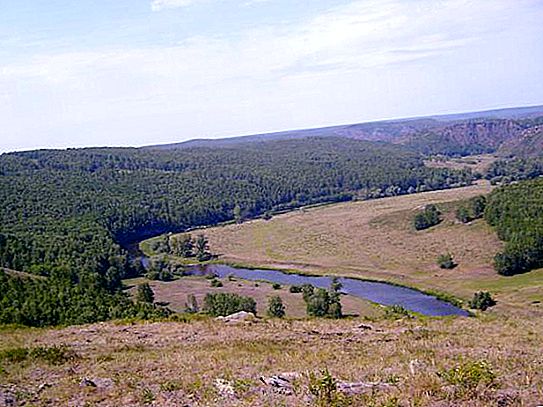
The Sakmara River flows from north to south along a spacious mountain valley. She goes around the Zilair plateau, and breaking into a deep mountain gorge, picks up speed. Then the river turns west.
Sakmara is one of the most significant tributaries of the Urals and flows into it on the right near the city of Orenburg. The total length of the river is nearly 800 km, and its basin area exceeds 30, 000 km². The water level in the Sakmara River depends on the season. In spring, it reaches a maximum, although severe floods can occur in other seasons.
Title
Toponymists believe that the name comes from the words of Bashkir origin "sak" ("carefully") and "bar" ("go", "move"). Literally, this name most likely means "a river that you need to drive carefully." And this is connected not only with geographical features, but also with the fact that in ancient times these places were borderline - along the Sakmara there was the southern border line of Bashkiria.
Tributaries and nutrition
Zilair, Big Ik and Salmysh flow into the Sakmara river. The largest tributary is the Big Ik, its length is 341 km. But the main source of food for Sakmara is snow cover, its share is 77% of the annual runoff. Rains give 11%, and groundwater 12% of the runoff.
The nature of the water regime
Sakmara has an Eastern European type with a predominance of spring runoff. In summer and autumn, the level of the Sakmara River rises due to rains. In early April, spring floods take effect. It gradually subsides by mid-summer, alternating with one-time floods under the influence of precipitation. However, these differences rarely raise the level by more than 0.5 meters.
Autumn rises caused by an increase in precipitation and a decrease in evaporation often reach rises of 0.9 m above the boundary. Winter is characterized by even more swings - up to 1 measure.
Settlements
There are several cities and small towns on Sakmara. The most significant of them are Kuvandyk, Nikolskoye, Saraktash, Sakmara, Black Otrog, Tatar Kargala. Most settlements are affected by annual floods that cause elevated water levels in the Sakmara River. Orenburg, near which the river flows into the Urals, suffers less about the violence of the elements.
Uneasy character
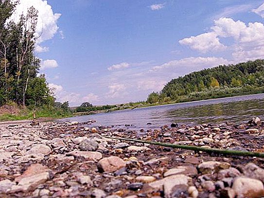
Experienced tourists say that Sakmara is that shrew. Its waters are cold, and the current is fast, especially near the drain. It is the coldest river in Bashkortostan. Its channel is winding, the right bank is dotted with tributaries, and the left is steep and steep.
But if this can frighten or alarm someone, then it’s only not water tourists!
Nature
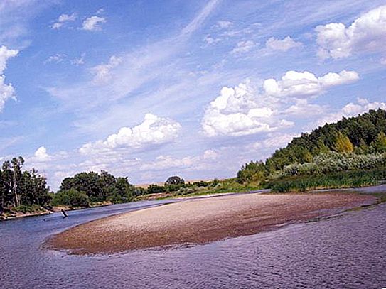
If you decide to go to these parts and personally see what it is like, the Sakmara River in Orenburg, be sure to take care of the photo equipment! Believe me, there are a lot of subjects for filming here. The banks of the river are very picturesque, in some places steep cliffs protrude above the water. Caves, grottoes, karst wells are not uncommon for them.
Sakmara rafting
These places attract kayakers and brave rafts. Although a small part of the river is suitable for rafts, near its mouth.
For kayakers, the upper regions are most attractive. Tourist rafting often starts in the village of Yuldybaevo, where near the bridge there are excellent places for collecting boats. Experienced tourists are advised to take with them everything they need, and not to hope to buy food in the place. These places are a real wilderness, rafting, here you can not meet a single settlement for several days.
The best time to travel is May and June. The flow velocity in spring often exceeds 2 m / s, but in summer it drops to 0.5 m / s. The width of the river in these places is small - 10-20 meters.
Rafting requires experience. The river carries many dangers, for it is characterized by a threshold, rifts, dams, clamps.
The most dangerous obstacle is the Yamantash threshold. From Yuldybaev to him about 15 km. The threshold extends for one and a half kilometers and consists of three difficult steps with rifts. Some people prefer to cross it overland, and the words that it’s not worthwhile to climb into the water without ford reconnaissance are especially relevant in these places. Some daredevils who tried to conquer Yamantash paid for it with their lives.
The next complex shiver with protruding stones is also not simple. But after 10 kilometers the river will become calmer. The cliffs on the banks are like fairy castles.

Another difficult threshold is located near the confluence of the tributary - the Barakal River. He appears suddenly just around the corner. The waterfall reaches about a meter in height, and in the middle of the river stands a huge rock. After the mouth of Zilair, Sakmar calms down again. After Yantyshevo or Kuvandyk station, where many complete the rafting, Sakmara takes on the calm character of a flat river.


