In 1931, in the Far East, working people began to settle in the floodplain of the Iman River: builders of a timber industry enterprise and loggers. So the village of Stroyka appeared. In 1957, the village was renamed Roshchino in honor of the hero of the Civil War, who was shot in 1919.
Geography
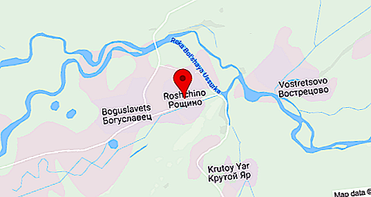
The village of Roshchino of the Krasnoarmeysky district of Primorsky Krai today is equated to the territories of the Far North. It stands on the left bank of the Bolshoi Ussurka - a river formerly called Iman. The village is located 115 kilometers above the mouth, in the place where Bolshaya Ussurka flows into the Ussuri River - a large tributary of the Amur.
Roshchino’s companion is the village of Boguslavets, adjacent to it from the west. The distance to Novopokrovka, the regional center, is 31 kilometers. To the north of Roshchino there is a road to the villages of Kedrovka, Vostretsovo, Invisible, Glubinnoye. In the south-east of the village are the villages of Dalniy Kut, Krutoy Yar and Timokhov Klyuch. Opposite Roshchino, on the right bank of Bolshoi Ussurka, stands the village of Vostretsovo.
Pre-war and military history
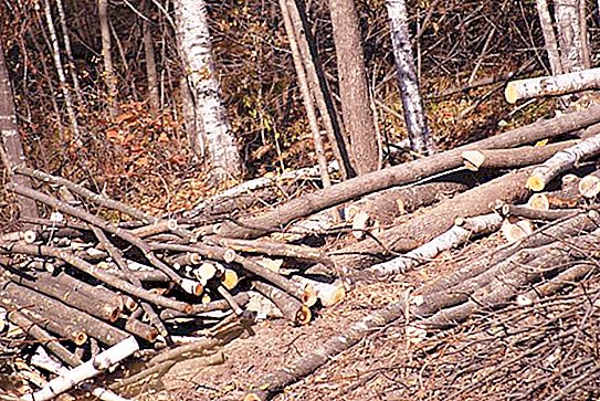
Like many taiga settlements in the North, Roshchino, Primorsky Krai, comes from a timber industry enterprise. The first school appeared here in 1938 and at about the same time an airfield began to be built. It was built by prisoners by hand, with wheelbarrows they dragged stones and soil. They lived in tents, built two houses for the flight crew. And then the war began.
Despite the fact that the strongest and strongest taiga went to the front, the Khanichez timber industry enterprise continued to work and regularly supplied timber for the needs of the defense industry and the army.
After the war
At the end of the Second World War, it was necessary to restore the national economy, and the volume of procurement rapidly increased. Hand saws were replaced by gasoline, bulldozers and mechanical loaders began to be used. In August 1948, the Sinepad construction site began to work. Road brigades functioned, which built a canteen, hospital and post office, as well as residential buildings along Shkolnaya, Leninskaya and Oktyabrskaya streets.
In order to expand the raw material base of a rapidly developing mining industry and systematically study the territory of the north of Primorye for ore deposits, in 1952 a geological exploration expedition was formed in the Iman floodplain, and the village of Stroyka became its center.
Roshchino development
The appearance of geologists in the village gave a new impetus to the development of infrastructure and the economy. Largely thanks to the expedition of Roshchino of the Krasnoarmeysky district of the Primorsky Territory, it began to grow and change its appearance.
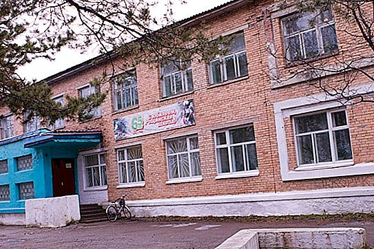
In 1962, the airport building was erected; in 1965, the Yubileiny club was built on the site of the barracks. The PMK forces erected brick buildings of the department of working supply and LPH offices, a two-story store, and a school. In 1965, wood processing workshops were built at the Roshchinsky Leskhoz, which, without prejudice to the protection and restoration of the forest, began to produce a fence, shingles, parquet, rough furniture, timber and planks.
Over time, in the village of Roshchino, Primorsky Krai, a new geological ODS appeared. By distribution, graduates of prestigious technical schools and universities from all over the USSR began to come here. Many remained and acquired families.