The Republic of Karelia is the land of forests and blue lakes. The latter there are at least 60 thousand. One of them is devoted to our article. This is Segozero Lake, located in the central part of the region. Next, you will learn about the hydrology, features and ichthyofauna of this reservoir.
Lakes of Karelia
Karelia is one of the most lake regions on the planet. Karelian reservoirs are diverse and extremely picturesque. Among them are Onega and Ladoga lakes, huge in size, and very tiny lakes, lost in the depths of virgin forests and here called “lambushki”. But it is small ponds prevailing in the region whose mirror area does not exceed one square kilometer.
Many Karelian lakes are flowing and connected to each other by rivers or small rivulets. Their banks are often rocky and steep, quite often there are placers of boulders of bizarre shapes. The origin of most of the lakes of Karelia is glacial. Their names are noteworthy and curious, based on Finnish, Karelian, Veps, Sami words.
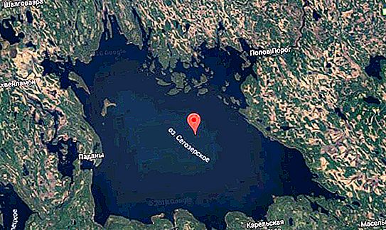
The fifth largest water body in Karelia is Segozero. The lake is located in the center of the region within the Segezha and, partially, the Medvezhyegorsk regions of the republic (the map is presented below). Next, we will tell you more about this reservoir.
Segozero Lake: photos and general information
The name of the reservoir comes from the Karelian word sees, which means "bright." The shores of the "Bright Lake" are the ethnic territory of the Padan Karelians - a subethnos, in the anthropology of which there are Mongoloid features. The total area of Lake Segozero is 815 square kilometers, the maximum depth is 103 meters. The coastline is about 400 kilometers long.
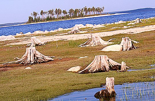
Lake Segozero was studied in detail by the Russian geographer Gleb Vereshchagin in the 20s of the last century. The expedition led by this scientist investigated a total of over a hundred Karelian lakes. The pond belongs to the White Sea basin. Its main tributaries are Luzhma, Sanda and Woloma. The Segezha River also flows from the lake, connecting it with neighboring Vygozero. In 1957, as a result of the construction of the Popov Porog dam, the water level in Segozero was raised by 6.3 meters.
Hydrology of the lake
The average depth of Segozero is 29 meters. The northern part of the reservoir is the deepest. Depths of 40-60 meters prevail here. But in the central and southwestern parts of the lake there are mainly shallow areas (no more than 10 meters).
Segozero is a fresh lake. Mineralization of water in it is low - up to 40 mg / liter. The acidity index (pH) ranges from 6.5 to 7.0. The color of the water in the lake is yellowish, transparency is 4.3-5.2 meters, and in the bays - no more than 3.2 meters. In the summer months, the water warms up to + 16 … 17 degrees (in the bays - up to +18 ° C). The pond freezes in early December, and is completely freed from the ice chains - by mid-May.
Most of the bottom of the lake is covered with gray-green and brown silt. At depths of up to ten meters, sand deposits are found. In total, there are about seven dozen islands of various sizes on the lake. Most of them are located in the north-eastern part of the reservoir. Ten kilometers from the village of Karelian Maselgi is the unique island of Dulmek, which is a monument of geology. It is composed of dolomites two billion years old, in the body of which fossilized remains of ancient algae were discovered.
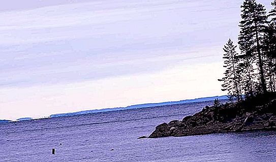
Shores and surrounding landscapes
The shape of Lake Segozero resembles a triangle oriented with its right angle to the south-west (photo is presented below). The length of the reservoir is 49 km, the maximum width is 35 km. The coastline is heavily indented by deep and narrow bays-lips.
Coastal landscapes are very diverse: from steep and rocky to low-lying and swampy. But dominated by a slightly elevated coast, completely overgrown with dense coniferous forest. Of the hydrophilic vegetation, horsetail, pond, reed, reed, yellow egg and some other species are represented here.
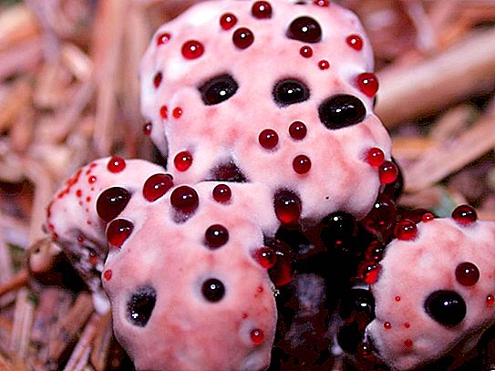
In lakeside forests - an abundance of mushrooms and berries (blueberries, lingonberries, cranberries). Grouse, partridges and other birds feed on the berry fields. Bears are also enjoying food here, so a meeting with a clubfoot animal in the local forests is quite likely. Of the local mushrooms, Gindellum Peka stands out, in popular terms - "cranberries in sugar." Its white hat is completely covered with small ruby-colored “beads”. The mushroom, although not toxic, is inedible due to its strong bitter taste.
Fishing on Lake Segozero
The pond has always attracted many fishing enthusiasts. It was once said about this lake: "It bites on a bare hook!" The reason for a good beak lies in the saturation of water with oxygen and the abundance of plankton. Today, there are fewer fish here, but it is still more than enough for amateur fishing.
Today, 17 species of fish live in Segozero - vendace, grayling, salmon, ide, roach, burbot, perch, bleak and others. Fishing on the lake is allowed year-round. The most suitable period for spearfishing is the beginning of autumn. At this time, the water in Segozero is as clear as possible. The most fishy places are the Panda Bay, the Sondala Bay and the island of Akkonshaari.