This river has been protected by law since 1980, as it is declared a State Natural Monument. According to legend, the name of the river comes from the word Tatar, meaning beauty. The legend, which has many different interpretations, says about the beauty drowned in it - a Tatar girl.
The article presents a short story about the picturesque river Usmanka of the Voronezh region.
Geography
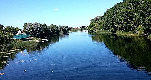
Usmanka (or Usman) carries its waters through the territories of the Voronezh and Lipetsk regions of Russia, being a tributary of the Voronezh river. The river bears two names. The name Usman belongs to the upper current, Usman belongs to the lower one. The source is located on the Oka-Don plain, and the mouth is located on the left bank of the Voronezh River - at the place of their confluence.
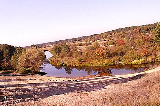
The shores and valley of Usmani are more marshy and represent a large number of small lakes connected by channels. In summer, especially in dry times, the pond becomes shallow, so dams and dams are built to maintain the water level.
The Usmanka River originates from the village of Moskovka, Lipetsk Region of Russia (Usamsky District). Then it flows through the territories of Verkhnekhavsky and Novousmansky districts of the Voronezh region. 4 kilometers southeast of the village of Ramon (Ramonsky district) flows into the Voronezh River.
River characteristics
Usmanka is a left tributary of the river. Voronezh. The length is 151 km, the total basin area is 2840 km 2. The average annual volume of water flow is almost 2 m³ per second. (117 kilometers from the mouth). On average, the width of the river is from 10 to 20 meters, reaches 50 meters on floods. The course of the river is moderate.
The river in Voronezh at its very beginning flows from north to south, then turns to the west, and then to the north-west. Use - water supply of settlements. It should be noted that the Voronezh Reserve is located in the river basin.
Settlements
The following settlements are located along the channel of the Usmanka River from the source to the mouth:
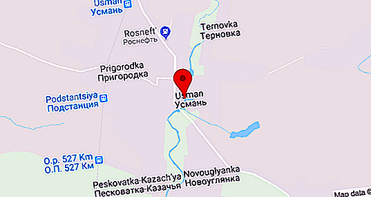
- The Usman district of the Lipetsk region: the villages of Moskovka, Krasny Kudoyar, Pushkari, Bochinovka, Krasnoye, Ternovka, Watchdog, Peskovatka-Kazachya, Novogulyanka, Peskovatka-Boyarskaya and the city of Usman.
- Voronezh region: villages of the Verkhnekhavsky district - Tolshi, Vodokachka, Zheldaevka, Enino, Lukichevka, Zabugorie, Ugljanets, Paris Commune, Nikonovo; villages of Novousmansky district - Orlovo, Gorki, Malyi Gorki, Horseradish, Rykan, Atheist, New Usman, Nechaevka, Otradnoye, Babyakovo, Borovaya (railway station); Ramon village, Ramonsky district (5 kilometers from the lower reaches).
Main tributaries
In total, about 20 tributaries with an average length of 600 meters to 50 kilometers flow into the Voronezh Usmanka River. The largest: Matryonka, Belovka, Hawa, Privalovka, Khomutovka, Maid.
At the State Reserve, the river receives several small tributaries-streams that flow into the river mainly on the left side. The main tributaries-streams: Maiden, Yamny, Privalovsky (or Snake), Ledovsky, Shelomensky.
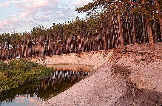
Vegetation
On the border of the Lipetsk and Voronezh regions near the Usmanka River on its right side, as noted above, is the Voronezh State Nature Reserve.
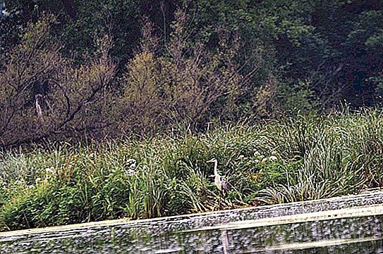
The vegetation is mainly represented by aspen and oaks, among which old pines stand alone. Pine-deciduous forests grow here. The first tier is represented by pine, the second by aspen, oak and occasionally birch, and the third by Tatar maple, warty euonymus, mountain ash, buckthorn brittle, etc.
Grass cover is represented by broad-leaved crops. A significant area (approximately 40%) is occupied by pine plantations of various ages. Birch trees are much smaller. In the floodplain of the Usmanka river along the banks there are small areas with black alder. Young oakwood, aspen, and hazel in some places grow here. The most common woody vegetation: pine, oak, alder, birch, aspen, elm, ash, linden, maples (holly, Tatar, field), fragile willow, apple tree and pear.
Meadows extend to a greater extent in the floodplain of the river (797 ha). During the flood period, floodplain areas of the river with abundant vegetation are flooded.


