
Om is a river flowing in Western Siberia. It refers immediately to three basins: the Irtysh, Ob and the Kara Sea. The first information about the Omi River can be found in the Siberian drawing book, which was compiled in 1701 by Semyon Remezov. In our article, we will talk about the Omi River, its features, geographical location and interesting facts about this reservoir. Well, now in more detail.
Title
The name Om River received from the Turkic word "quiet" ("om"). And in Irtysh and Baraba, the local population calls it diminutively: Omka.
Location
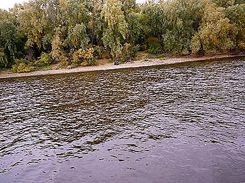
Lake Omskoye, where the Om River originates from, is located among the marshes in the Vasyugan Valley and is the source. Further, the river stretches along the Baraba lowland. The mouth of Omi is located in Omsk, on the right bank of the Irtysh.
River description
The catchment area of the Omi River is 52, 600 square kilometers. On average, water consumption per year is 64 cubic meters per second, and the maximum is 814. The length of the Om River is 1091 kilometers. In Soviet times, ships traveled along the river from Kuibyshev to the pier of Ust-Tark. Now Om is not included in the list of important inland waterways of Russia. The main tributaries of the river:
- Achairka.
- Icha (upper and lower tributaries).
- Ugurmanka.
- Uzakla.
- Kama.
- Tarka.
- Tarbuga.
- Tartas.
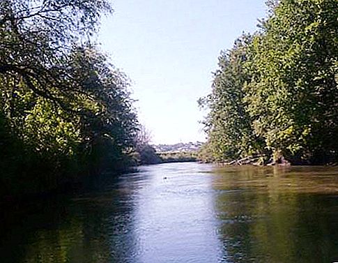
Small tonnage vessels go along the river, but only starting from the place where Tartas flows into it. In the upper reaches, the river flows through marshy and forested areas. Then the steppe begins, and on the banks - the first villages. Then there are more and more of them, cities appear. Many fishermen are interested in the question of which fish is found in the Om River. It has a lot:
- sterlet;
- nelma;
- vendace
- zander;
- Pikes
- perch;
- crucian carp;
- roaches.
River valley
The river valley is unclear, the slopes merge with the surrounding area. In addition to the upper course, it looks like a trapezoid, in some places asymmetric. The width of the valley is from two hundred meters to eighteen kilometers. In the upper reaches the slopes are gentle, and in the lower reaches they are steep, sometimes steep. There are plowed.
Floodplain Omi
The floodplain of the river is bilateral, in some places boggy and crossed by individual manes. Below - one-sided. The minimum width of the floodplain is two hundred and fifty meters, the maximum is sixteen and a half kilometers.
Channel and course
The width of the Omi channel at low water is between 40 and 84 meters. In some places on bends - from 110 to 220 m. Depth on rifts is from 0.3 to 1.5 meters, and on stretches from 2 to 4.1 m. The course is quiet, its speed is from 0.3 to 1.4 meters per second. The channel is expressed unclear, with a length of five kilometers from the source. This segment looks like small extensions in the form of mini-lakes that connect to each other. And the lower channel is unbranched and very winding.
River features
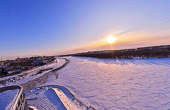
Om is a river fed by melting snow. High water begins in May and lasts through July (sometimes inclusively). Freeze-up starts in late October or early November. Ice begins to melt in April or early May. Low-water shores are open; a bush is growing wildly on them.
The width of Omi varies in the upper reaches from 15 to 25 m, in the middle - from 150 to 180, and in the lower reaches - up to 220 meters. Depth can range from half a meter to 5.5 m in the lower reaches and from 0.2 to 3 m in the upper ones.
In 1982, at the mouth of the river during work to deepen the bottom, a barge flooded by Kolchak residents was discovered. There was a drowning in 1918. Artillery ammunition was found on the barge. An embankment was erected around the flooded vessel. From 1982 to 1984, sappers removed, removed, and detonated ammunition found on the river bottom.
Near the place where Om flows into the river. Irtysh, archaeologists have found an ancient settlement called Bolshoy Log, an area of 2500 square meters. Dwellings, implements and ceramics of the Late Kulai appearance were found. In addition to this log, there are several others that flow into Om: the Killed, Syropyatsky, Kornilov and two Bezymyannye (at the small village of Samarinka and the regional center of Kormilovka).

 - 2016 Nobel Peace Prize Laureate")

