The Uda River, flowing in the territory of Buryatia, is one of the largest tributaries of the Selenga. The length is 467 km, the area of the river basin is 34, 800 square meters. km
Title
The origin of the name is unclear, there are several versions: from the ancient Mongolian word meaning willow, which grows in abundance along the banks; from the Uduit tribe, exterminated by the Mongols; from the Mongolian “ude” - “noon”, since, according to legend, the Mongolian horsemen first arrived at the nameless river at this time of day; or from the Selkup word “ut” - “water”.
Tributaries of the Uda River
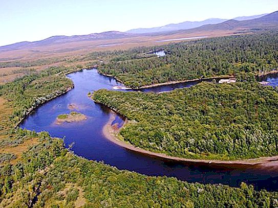
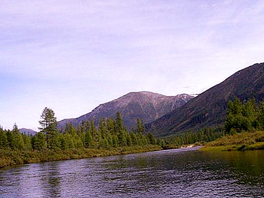
Uda originates in coniferous forests in the southwest of the Vitim plateau, at an altitude of 1055 meters. The main tributaries: Mukhey (93 km), Pogromka (44 km), Egita (55 km), She (173 km), Kudun (252 km), Kurba (227 km), Bryanka (128 km). The river flows in a southwest direction. In the section from the source to the Ona confluence, the channel passes through the hilly region of the spurs of the Vitim Plateau, then the relief becomes more intersected, and the flow is among low ridges (1200-1800 m), most of which are oriented in the northeast direction.
Parts of the river
The Uda and Selenga rivers (or rather, their basin) are elongated in the latitudinal direction and are uniformly developed along both banks. According to the nature of the structure of the river valley, channel and flow conditions, the body of water is divided into two sections: before the confluence of Ona and from its confluence to the mouth.
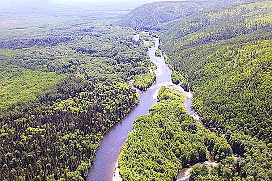
In the first section (261 km), the river flows along hilly, overgrown with forests, and in places of depressions - marshy terrain. The river valley is deep, slightly winding, the width along the bottom increases from half a kilometer in the upper reaches to 5-10 km at the end of the site. The slopes are quite steep, have a height of 50 to 300 meters, composed of granites and other crystalline rocks. The Uda River flows along them. This territory is dissected by channels of tributaries, dry gullies and ravines, overgrown with forest and shrubs. The width of the channel varies from 10 to 40-60 meters, the banks are steep and steep, with an average height of 1-2 meters, overgrown with bushes and trees along the entire length (pine, larch, birch, poplar, willow).
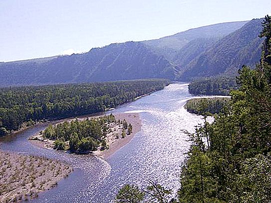
In the second section (206 km), the river valley is floodplain and deep. The floodplain is mainly left-bank, two to three kilometers wide, in the Ulan-Ude region only 20-50 meters. It is very convenient fishing on the Uda River. The surface of the floodplain is heavily indented by numerous channels, elders and hollows. The width of the valley along the bottom is from 10-15 to 19 km, its slopes are steep, in the lower part they are terraced, overgrown with dense coniferous forest. In the lower reaches, the slopes decrease, breaking off with steep ledges to the river floodplain. The Uda River has a winding and highly branched channel, except for the last seven kilometers. The width of the watercourse is, on average, from 70 to 100 m, the largest - 260 m. The slopes are located at a distance of one hundred meters to a kilometer from each other, the depth in these places does not exceed 0.7 m, and on the stretches - a meter and a half. The greatest depth is 3.2 m. The river feeds mainly on rainwater, but in some years the flow of meltwater reaches 30% of the volume. Floods begin in the first half of April, reaching a peak at the end of the month, with the beginning of the ice drift. Water is falling by the end of June.
Nature of the river
In summer and autumn, up to five rain floods lasting from 20 to 30 days pass along the river. The highest level of water rise is observed in August-September. Once every three to five years, rains cause flooding. Freeze-up takes place in late October or early November, the ice lasts 155-180 days, and in the upper reaches of the Uda it completely freezes. The river is used for water supply, from the village of Oninoborsky to the confluence with the Selenga, timber is fused in bulk. Uda crosses the lands of several wildlife reserves. There are several villages along the lower stream, and on the both banks of the estuary there is the Buryat capital - Ulan-Ude. The Uda River is rich in such types of fish: grayling, tugun, taimen, pike, omul, burbot, because of which you can often see fishermen on the banks. In the forests of the Khorinsky district, hunting for moose, Siberian roe deer, red deer, wild boar, lynx, and bear is especially effective.
: description, history, attractions, leisure features and reviews")
")

