This place, known as Smolensk Square, has long been called the Smolensk Market. Actually, there were two markets here: Smolensky, with a large assortment of goods (primarily food), and the Haymarket, which was closely connected to it, where there was trade in firewood, boards and hay.
And today the Smolenskaya-Sennaya and Smolenskaya squares are so close adjacent that it is very difficult to determine the border between them.
History
Russian writer V.A. Gilyarovsky called the Smolensk market "the child of the plague of 1771." Of course, the market at this place was even before the plague (from the 17th century), however, the events of that year, which pushed trade from the central part of the city to its outskirts of those times, accelerated the development of market trade on Zemlyanoy Val.
In the 17th century, the Streletskaya settlement G. Anichkova (colonel) was located inside the Zemlyanoy Val, and the Tsar Shchepnaya (wood) court was located on the outside. Rafts with forests were brought here along the river for government construction. In those days, the Church of St. Nicholas appeared on Chips, existing to this day. In the settlements at that time, the yards were small, and 10 lanes parallel to each other appeared to the Smolensky market. After the liquidation of Streletsky’s troops and the transfer of the capital to St. Petersburg, the Sloboda lands were settled by merchants and raznoshchintsy, and a free forest market appeared on the site of the former sovereign of the court.
In early July 1736, the market and the surrounding buildings were completely destroyed by fire, but subsequently both the market and the surrounding settlements were restored. The earthen rampart, which had become dilapidated as far back as the 18th century, was demolished in 1820, and the Smolensky market was formed on the spacious cleared area, which operated until the mid-twenties of the last century. In 1875, the city council built stone trading premises on the square, but trade continued around both with hands and carts. After the events of 1917, the “French row” arose here, where the descendants from the nobility were trading.
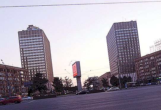
The project for the reconstruction of the square was drawn up exactly in the middle of the 20th century by a group of architects: Gelfreich V. G, Steller P. P., Lebedev V. V.
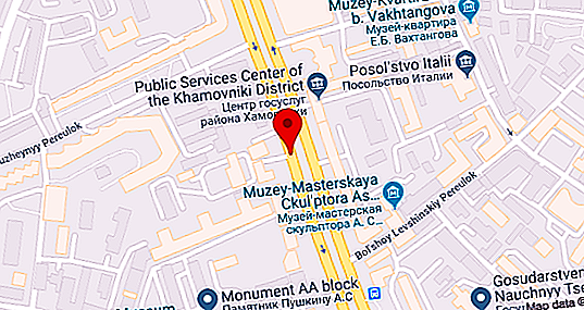
Location and origin of the name
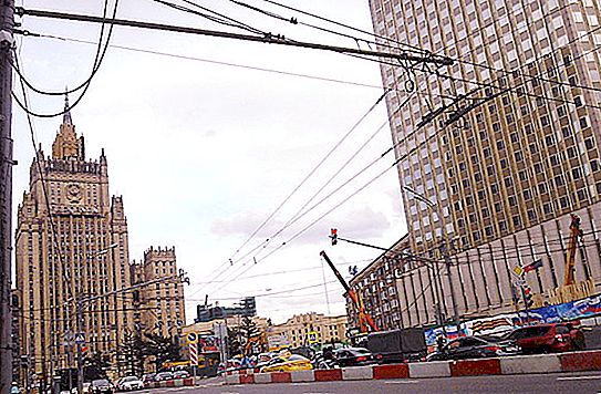
Smolenskaya-Sennaya Square of Moscow is located in the Arbat area (Central Administrative District of Moscow). The border with the Khamovniki district runs along its southern outskirts. The square adjoins the Garden Ring, Smolenskaya Square, Smolenskaya Street and Smolensky Boulevard. One of the remarkable structures standing on it is the building of the Russian Ministry of Foreign Affairs.
It got its name from the name of two markets that were once located at this place: Smolensky and Sennoy.
Located near Smolenskaya-Sennaya metro station. This is the Smolenskaya station of two lines: Arbatsko-Pokrovskaya and Filevskaya. Apparently, getting to her is easy.
Description
Smolenskaya-Sennaya Square, in fact, is a continuation of Smolensky Boulevard from the exit point on it Glazovsky Lane from the central part of the city and the Ruzheyny Lane, coming from the Moscow River.
Passing to the north, the square in front of the Foreign Ministry building forms, with a Smolenskaya street facing the left, a large triangular square, which reaches Arbat and after it passes into Smolenskaya Square.